Notoriety, Reclusiveness:
California Tidefall Tales
This is the story of two rival California coastal waterfalls. Their names are McWay and Alamere Falls. They have never crossed paths but may have unknowingly mingled in the deep waters of the Pacific blue.
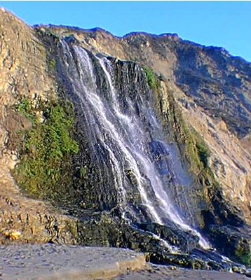
Each has its own charm. Where Alamere is the stocky, rough-and-tumble type, McWay is slender with an even flow. And each has its followers.
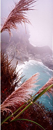
McWay, right along Highway One near the town of Big Sur, is the more famous of the two. Visitors from around the world come to marvel at its beauty, snapping photos, some even making their way down to the off-limits beach to touch it. In the summer, daily tour buses from Monterey and Carmel lead them to the top of the fall.
The crown jewel of California cataracts, McWay is often found on guidebook covers. It can make you feel transported to the far reaches of Hawaii or the South Pacific; upon first sight, it may even make you shriek with delight. You could easily miss this gem if you're concentrating on the hairpin turns so famous along this part of the coast. But take the time to pull into the parking lot and pay the park's $6 entry fee. You won't regret it.
A 10-minute stroll takes you to a site with a view that will leave you awestruck. The slender, 50-foot fall cascades onto a white, sandy beach and into the churning froth and turquoise of the Pacific. McWay is part of the Julia Pfeiffer Burns State Park.

Alamere Falls is more of a recluse. It is a good six-mile hike (about two hours) from any road; and it is 10 miles from the closest town, Bolinas, in West Marin. (Bolinas, as you may know, is somewhat of a recluse also.) A wide creek tumbles over a bluff, then cascades 40 feet along exposed rock onto Wildcat Beach and the Pacific surf below. At its heaviest flow, Alamere can stretch some 25 feet across.

Rarely do you see more than a couple of people at Wildcat Beach. Compared to McWay Falls' notoriety, Alamere's following is modest, limited to those people willing to work to get there.
With the exception of Phil Arnot in his 1987 book, "Point Reyes: Secret Places & Magic Moments," few have written about it. Stated Arnot in his book, "One can sit next to the falls with feet dangling over the edge of the cliff and watch ocean breakers and white caps, seagulls and sandpipers... while marveling at the power and beauty of Alamere Falls."
"People who have never seen it before are quite impressed with it," said Arnot, who has visited Alamere more than 100 times over the past 40 years. "They don't ordinarily think of a waterfall plunging into the sea. They think of Vernal Fall or Yosemite Falls."
A waterfall that lands on the beach -- or in the sea -- is called a tidefall, according to Don Neubacher, Point Reyes' superintendent.
"People react strongly to the isolation and beauty of Wildcat Beach and the falls themselves," said Neubacher, who often hikes there. "There's a certain mystique about falls that fall into the ocean."
It's charm is also it's remoteness. In fact, it is so remote that it's been mistakenly reported (Los Angles Times) that Big Sur's McWay Fall is "the only California tidefall."
"I don't mind," said the sole hiker at Wildcat Beach and Alamere Falls on a recent Sunday. "The fewer people, the better."
Getting there
For McWay Falls: From Carmel, take Highway 1 south to the town of Big Sur. From there, continue on Highway 1 another 13 miles. You will see a sign on the east side of the road for Julia Pfeiffer Burns State Park. From the parking lot, take the Waterfall Overlook Trail. The phone number for the park is (831)667-0158.
